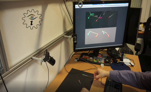
. solution demonstrating 3D measurements (on-line) in a calibrated stereo vision system. The data obtained from the vision system are sufficient to virtualize information about the observed objects (red and green ball). The results are displayed on the monitor in the form of a VR visualization (from the perspective […]
Yearly Archives: 2011
5 posts
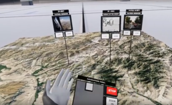
. (in progress) An application showing the possibilities of visualization and interaction with spatial data using a virtual environment. This solution is a step to build functional mobile VR GIS systems. The use of virtualized interfaces makes it possible to move away from costly physical human-machine interfaces.

